
Finally getting to Glacier, too early.
While in Arizona we decided that we would need a trip soon after returning home and getting doctor, dentist, etc things out of the way. We opted to head to Glacier National Park the second week of May. There were no ballgames to miss, no birthdays, and we'd get back in time for Mothers Day. Only issue we would face would be weather. It could be cold. It could snow or rain and thus keep us captured in a room or, at least, the car. Well, it turned out to be quite nice. Sunny, warm and dry throughout the trip till the day we came home. It even got to the upper 70's while we were there.
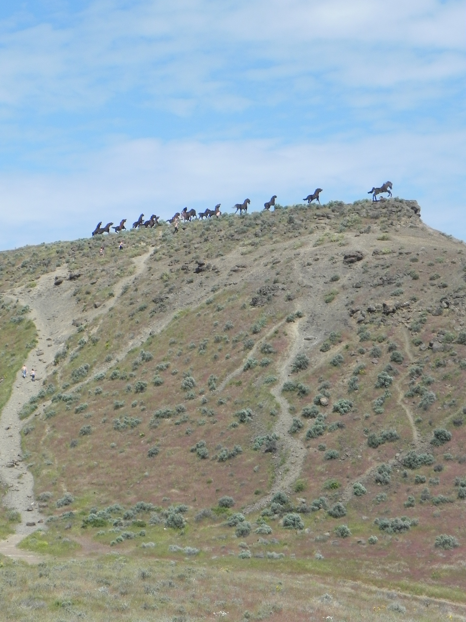
On the way to Sand Point for our first night and dinner with our in-laws we decided to finally stop at the Wild Horse Monument across the Columbia from Vantage. About 3/4's of the way up the grade you can pull off to the right and drive back a short way to a parking area and overlook below the hilltop that the sculptures are located. They are full sized and a LONG uphill walk. We got away late from home and wouldn't get to Sand Point till after 6 so we opted out of the climb on this trip. We're thinking of heading back to Glacier in September after school starts. We'll get out earlier and make the climb then. We watched some people go up and it takes about 15 to 20 minutes, one way. Got to figure an hour for the trip with time at the top for photos. The view above is from the lot and on top of the hill we'll be able to see over the hillside to the right in the panorama. The following photos should give you an idea of the distance and the size of the sculptures.


We stayed in downtown Sand Point and walked to Trinity at City Beach for dinner. It was nice enough to eat out on the patio. The food and service were excellent and we stayed till after dark. There were a few people left in the lounge when we finally headed out but the restaurant was empty. What can you expect for a Monday night? Sand Point is a walkable town with some interesting shops. The 20 minutes travel time was not boring. The bear sculpture on Bridge Ave, photo below, looked like a pig from straight-on but that's an optical illusion. Once you get a bit to the side you can see the extended nose is not a pig snout.


The next day we drove US 2 from Sand Point to West Glacier, following the Kootenai River valley into the Rocky Mountains. We stopped at Kootenai Falls, between Troy and Kalispell. There's a short trail back to the falls that I'd recommend. It's easy to traverse and the multiple cascades are pretty. The climb up and over the railroad overpass is the hardest part. Next trip in that area we'll hit the swinging bridge. It's downstream from the falls and about 3 times as far. Again, planning ahead to allow time will be needed. At Libby US 2 heads south away from the river. Some day we may go via Montana 37 up along Lake Koocanusa, a reservoir created by the Corps of Engineers Libby Dam, all the way into Redford, MT, just south of the border. That'd be a day's drive to get to US 93 and then head south to Whitefish and on to Glacier. We got to within 22 miles of the border when at Polebridge, MT, on the west side of the park, along the north fork of the Flathead River but our passports are in for renewal and without them we couldn't go into the Great White North. This fall we will have them, and our passport cards available so if we want to go "abroad" we can.


The lodge's web site blog had a posting suggesting things to do when the Going to the Sun Road through the park is closed, which at this time of the year it is. One trip takes you up the west side of the park along the North Fork of the Flathead River. It's about 35 miles, with more than 20 of it being gravel and pretty dusty. I'd rather have the dust than mud. As I wrote above you can get to the border on this road but the crossing has been closed, whatever that means. A gate? A fence of limited length to keep the refugees from Canada's winters out? Oh well, maybe we'll get to it someday. To get there you enter the park and take the Camas Creek road out to the North Fork road. When we got to Apgar, at the west end of Lake McDonald and the Visitor's center, we found that Going to the Sun road was open up to Lake McDonald Lodge, about 10 miles into the park, so we headed that way. The Lodge was not open, nor was there much in the line of services. We got some great photos of the lake. The west end had been hit by a major fire a few years ago and still hasn't recovered too much. That's why you'll see a lot of grey wood poles along the shoreline in some of the photos.


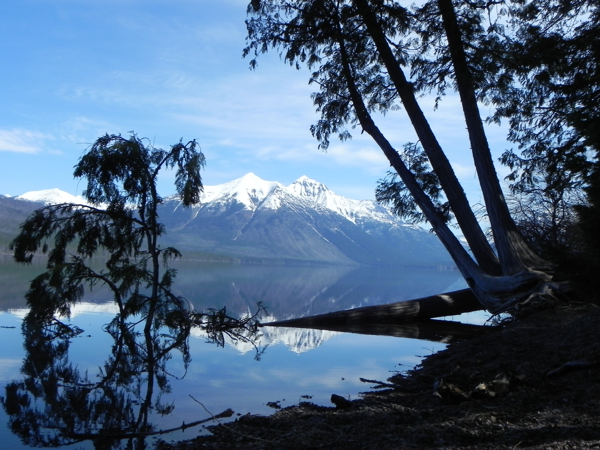


Lake McDonald. Apgar Range is on the left. Lewiston Range on the right with Heaven's Peak.
It's a beautiful drive and you get to see wildlife, deer and elk, some up close and personal. Especially the deer at this time. Where the road was paved the deer were out licking salt deposits left on the side from winter maintenance. About 5 miles from Polebridge you leave the park and national forest boundaries and enter private land. You can't miss the fact because the property owners have posted enough signs. Across a large meadow in this area we spotted a heard of elk, chowing down on spring grass and laying down chewing their cuds in the shade. The sun was warm and they hadn't lost all of their winter hair yet so shade is valuable. Remember these animals aren't comfortable unless it's freezing out.


A great thing about the drive is the last vestige of commercialism in this area, the Polebridge Mercantile. It's a truly general store and there are some cabins that are rented out. There's an outbuilding toilet for the cabins and they are building a shower structure this year. The best part of stopping here is it's bakery. Great goodies. We stopped and had one of their Chunky Monkey rolls. Nutella, walnuts and banannas are a wonderful combination. We shared one as a snack because they are so big. As we were sitting out front in the sun one of the locals who stopped for necessary baked goods told us to get the huckleberry bear claws. We went back to get one but they had sold out the stock. Luckily some were in the oven and we waited 20 -30 minutes for fresh. They had to put it in a sack for us because it was too hot to wrap in plastic. Took it and another Chunky Monkey back to the lodge for breakfast. Damn, they were good.


On our way back to West Glacier we took the turn-off to Columbia Falls which lies between Kalispell and West Glacier. You pass through Hungry Horse, MT on the way and we saw signs for the Hungry Horse Dam. Naturally we decided to head up the road. It's only about 7 miles. The dam forms the Hungry Horse Reservoir on the Flathead River in the Flathead National Forest. Nice drive and a beautiful lake but it's long and the roads around it to the campgrounds at the far end were questionable at this time of the year. It was getting late so we didn't investigate how far they went and we headed back down to West Glacier and the lodge.


Our second evening we went to Kalispell to ScottiBelli's for dinner. It's a family run Italian place. The family is Neopolitan and had restaurants in LA and momma decided to head to Kalispell after a number of years. A couple brothers now run it. Good food, although there was a problem with the bill on my debit card charge. They straightened it out after I called the bank and them.
I'm going to cut it off for now. Time to go work out. I'll get back to the trip along the south side of the park to East Glacier later.
Ciao for now