
Arizona Spring '19 (Continued #2)
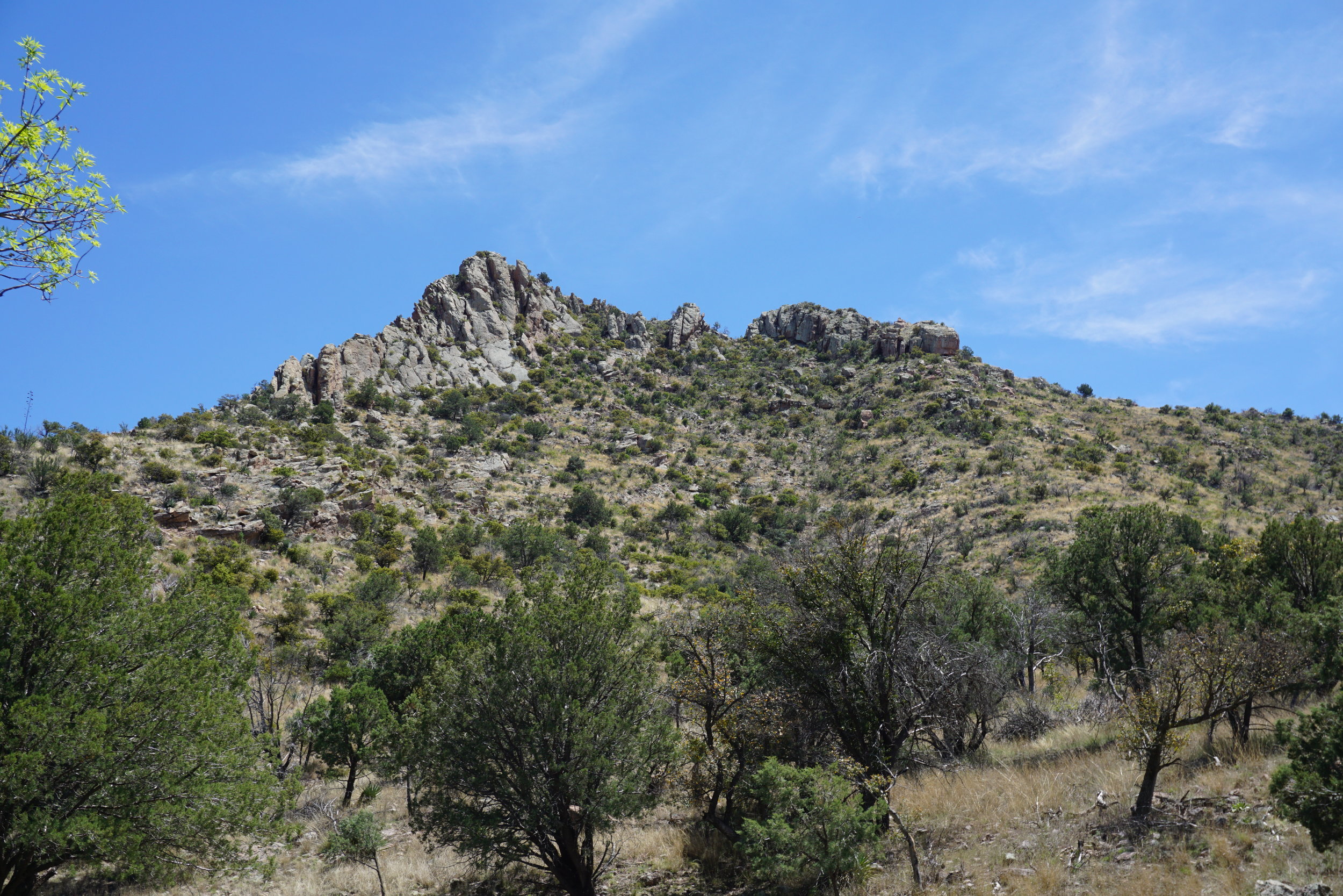
Well, no trip to AZ is complete without stopping at Copper Horse Vineyard to see our niece and her husband and check out the spring start of the vines. This time the road to the Chiricahua National Monument was still not open for the season. Last summer it was roadwork and flash floods from the summer monsoons. This year we drove around the Chiricahua range to Wilcox and then into the Monument from the West. We still want to drive the short route, in from Portal. It’s about 80-90 miles shorter and over the top of the mountains which had not been opened yet due to snow. The one saving grace was that we had scheduled to have dinner with Gina and Eric at the Gadsden Hotel in Douglas that evening so we basically made a trip around the range, after driving into the middle of the Monument and back out.
We stayed at the 4 Bar Cottages, a couple of units rented by Bill Cavaliere, about 7 miles east of Portal. https://www.fourbarcottages.com. The place is near a new store and grill that is just getting on its feet. Our unit didn’t have a kitchen but the Portal Grill is close and has good food for someplace in the middle of nowhere. It does a big business with the birders who stay in the area and go into the Chiricahuas for bird watching. There were 2-4 groups of them having breakfast the morning before we headed out to the Monument.


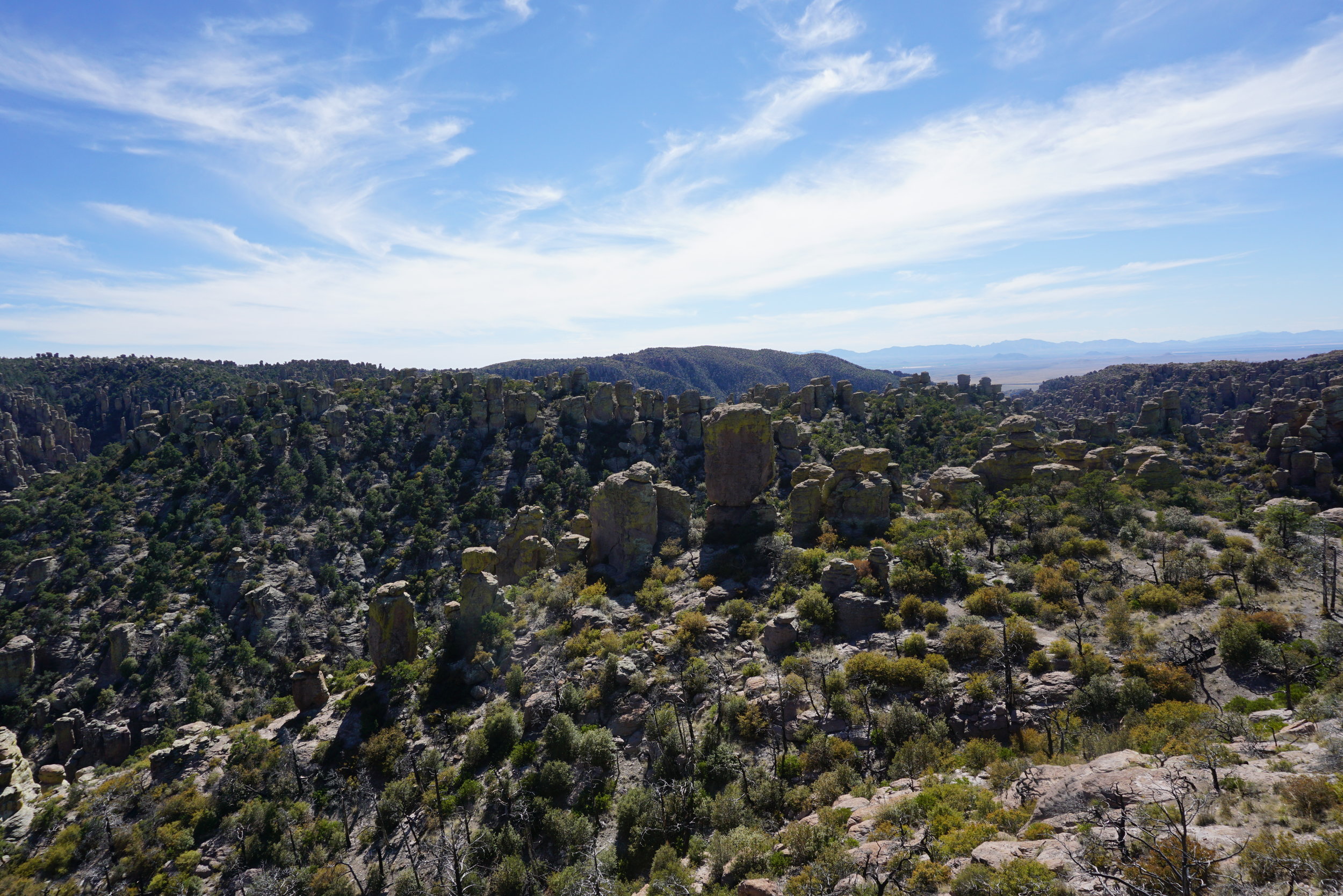


Shots from the viewpoint at the top


Hoodoos after hoodoos after hoodoos
Our next day trip was to head out to Crown King, AZ, an old gold mining town about 30 miles west of I-17 and a couple hours outside of Phoenix. You can get to it through Wickenburg, on US 93 on the way to Las Vegas. You have to drive through some pretty rough roads, though, and it takes over 4 hours. Take the one at the Bumble Bee exit off of I-17, or the next one to Cleator/Crown King. The road is in pretty good shape. It has to be kept open because there are multiple cell and communication towers on the mountain that Crown King is on. The Century Link trucks have to be able to get through and we saw several on the day we drove up there. A couple of times we came across road graders working on the road. Luckily at the times we did the road was wide enough for us to pass by. There are places where the road is cut through solid rock and not much wider than the mirrors on those trucks. They have to really slow down when going through the gap but that’s about the only time they do.
It’s a good drive to take, a bit dusty, hahaha. You need A/C because you don’t want to put you windows down. There’s a bunch of ATVs that use this road for access into the backcountry and all the riders had dust masks and goggles because of the environment. In fact, the ATV appeared to be the vehicle of choice for the residents of Crown King. Don’t think for a minute that the town is a complete backwater. One of the houses for sale, a 5 bedroom one, was priced at over $400,000, and that’s for a 30 mile dirt/gravel road, well water and septic tank utilities. There are some for under $150K but not many. Actually there are quite a few for sale, but many are over $300K. At least there is electricity, and wood for fireplaces and stoves, but that’s about it. There’s a small store and a saloon that has a large, lit outdoor patio for music during the summer weekends. There’s a small town, not much more than a bar and a couple houses, Cleator, on your way to Crown King. You can’t miss it because there’s a hairpin turn in the middle of the “town”.


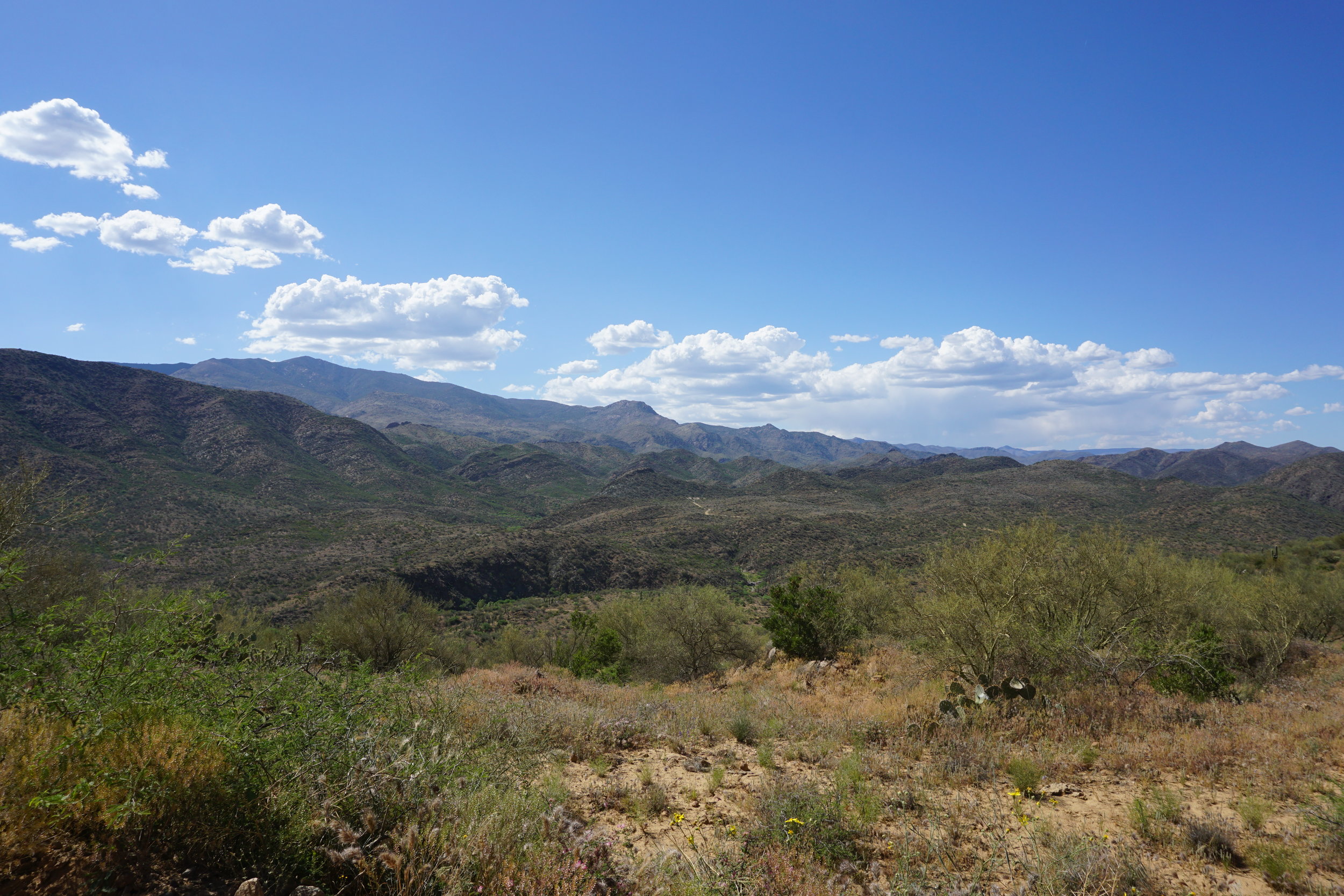


Mogollon Ridge from the Alki Canyon outside of Bumble Bee AZ
Well, this has taken about 3 days to complete. I had started and gotten past the Chiricahua Monument photos and saved the draft. When I went back to finish this post I had to update my Windows 10. That took 2 days and one night to complete due to the size of the download and Comcast’s lousy speeds. We’re paying for extra capacity but that doesn’t matter much when the system is overloaded by streaming during the day and evening. The downloads are nowhere near the 5MBS we are suppose to have.
Not a lot more to share from Arizona, however, we took a new route back. North from Phoenix, through southern Utah to St. George, then Salt Lake City to Boise, Lewiston and then home. I’ll try to get into that next week.
During the past two weeks we had a tough time here. My oldest brother, Pat, had been dealing with pulmonary fibrosis. Six and a half years ago he was diagnosed with it and given 5 to 7 years. He lived those last years with a vengeance but his time finally ran out. His best friend, Craig, was with him when he passed peacefully on July 31. Thankfully he had made his plans with Craig as his estate executor.
He had gone downhill quite quickly after this past winter. When we got back from Paris in March Cathy and I could not get out to the island to see him because of our colds, he was too susceptible to infections for us to go. So we went to Arizona as soon as both of us was healthy to travel and when we returned to Seattle at the end of April we could see a marked decline in his ability to move around. A short 10-15 foot movement around his house meant sitting down for 10-15 minutes for him to catch his breath again. We’re sad to not have him around but at least he’s not suffering anymore. At his request there will be a celebration of his life on September 14 at the house were he lived on Vashon Island for the past few decades. He wanted his friends and family to work on cleaning up his collection of wine and fine alcohol.
Until I get back to our trip past the Vermillion Cliffs following the Colorado River valley into Utah it’s
Ciao for now.