
Arizona Spring '19 (Continued #3)
This trip we decided to travel a new route back to Seattle. In previous years we’ve gone through Las Vegas to Reno to see our niece and her family. Since they’ve moved to Orlando, FL, familial visit doesn’t get involved so we decided to head to St. George and Salt Lake City, UT and on to Boise and Lewiston, ID. This gave us the chance to see another series of landforms, the Vermillion Cliffs. These form the edge of the Escalante and Bears Ears Monuments that the government is trying to close in order to allow mining interests to claim the land from the public for their profit.
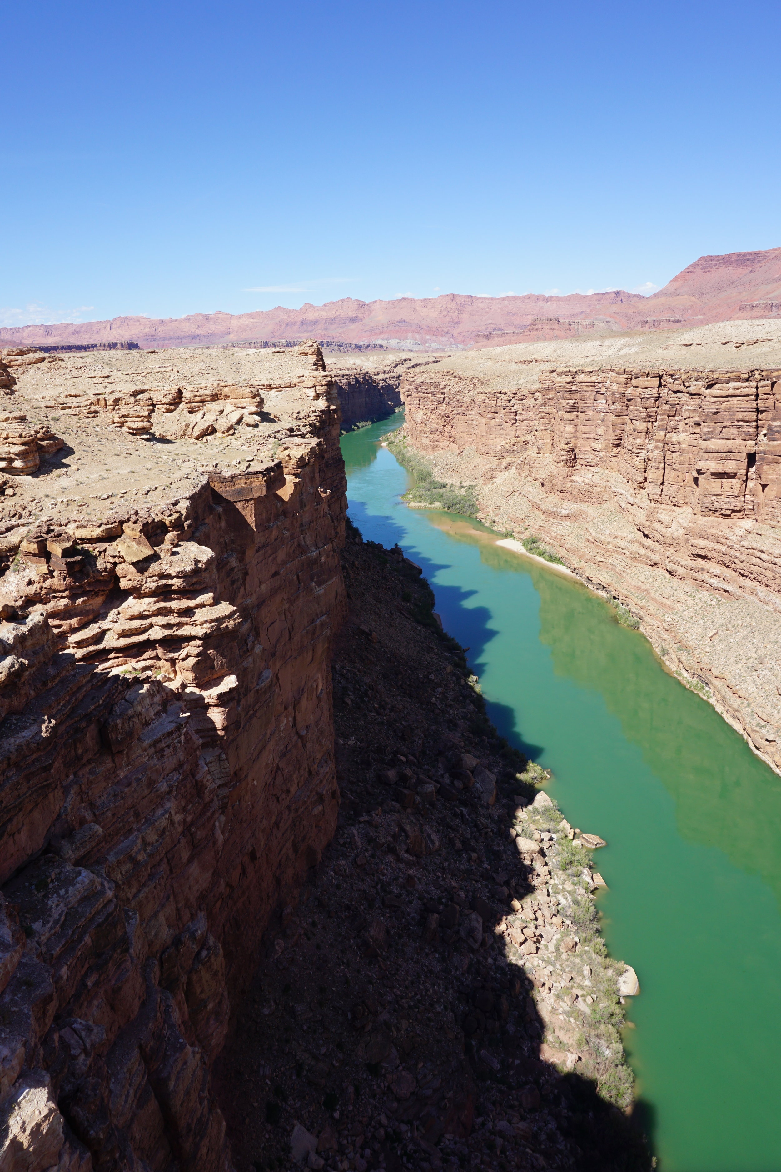
Our first day, Phoenix to St. George, led us to skirt the east side of the Grand Canyon. The panorama above is the Kaibab Plateau. It’s southern end is the North Rim of the Grand Canyon. The Colorado River runs along the middle of the photo. You can make out the edge of the river’s walls at the base of the hillsides, across the desert view. These are some of the more beautiful cliff faces in the country. Multiple bands of color from the ancient seabeds run for miles. Imaging the time it must have taken to erode this huge valley from the uplifted surface is hard. So much for the creationist version of the world. Of course they’ll say it was god’s idea to make it look this way. They have to. To accept the fact of science destroys their view of existence and world history.
The first sights after Flagstaff are the San Francisco Peaks, north of the city. Here’s where the ski areas are located for Arizona. You never really leave the desert till Idaho, the mountains are always tempting you from a distance. You do climb out of the Colorado Valley on US 89 to Jacob Lake, the access point to the North Rim of the Canyon. When we came through the road south, AZ 67 was still closed due to snow. It was a late winter, that’s why we chose the California route to Phoenix, it was still snowing in Eastern Washington the week before we left Seattle.


Pano from the reservation bridge

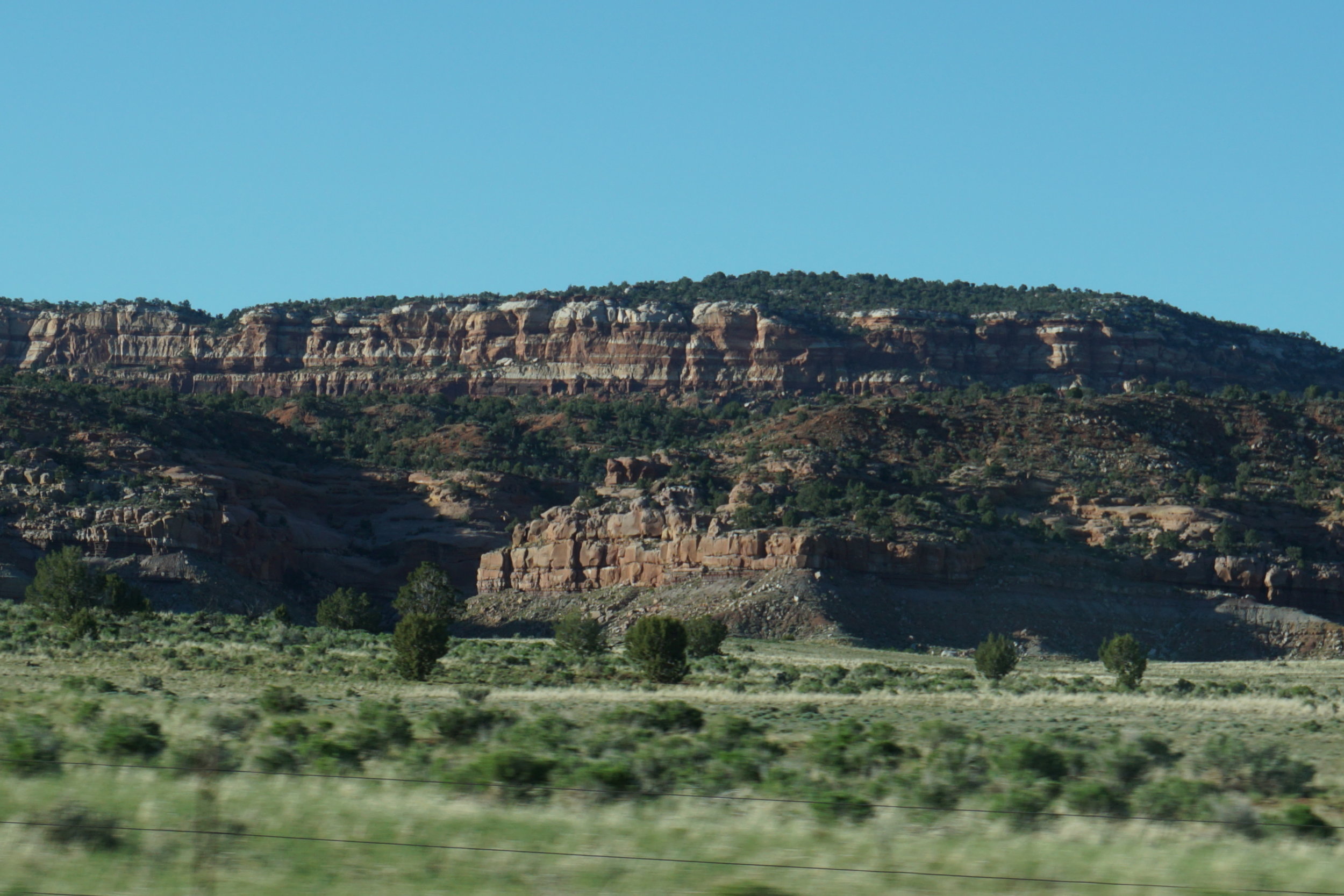
Pano of the southern end of the Escalante, Bryce and Glen Canyon plateaus
I just lost 3 hours of work and photo uploads thanks to Comcast. Internet was lost just as I was finishing this posting. Xfinity sucks for reliability. I’m stopping for the night and maybe a day or two, again. The photos are what take the time. There’s no way we get our paid-for speed because of crappy service.
From St. George we headed up the interstate to SLC and stayed downtown just a few blocks from the capitol. I was surprised at how small a “downtown” area we found. Not much to do or see if you don’t plan on going to the temple. Not a lot of different scenery until you get to where you can see the mountains south of SLC. From SLC we headed to Boise, ID, via I-15 to I-84.
We stayed in downtown Boise and ate at Asiago in the old town area. It’s been restored, or maintained, pretty well. Old buildings being repurposed for restaurants and shops, appropriate for a college town. There appeared to be more, and better, night entertainment choices than downtown SLC. It’d be a nice town, except that it’s in Idaho and generally not a lot of interest for someone used to metropolitan areas.


Leaving Boise we headed to Lewiston. We’ve been there before, when Rae was at WSU. Clarkston and Lewiston were only about 30 minutes away and when we went to Pullman for events it was real hard to find rooms so, hit the road south for lodging. We have never driven this route to Lewiston so it was new for us. We had considered heading north from Boise up ID-55 but the kind clerk at the motel informed us that the road through the mountains was regularly hit by landslides this early and between road repairs from the winter and slow drivers enjoying the views so it would be faster by a couple hours to go west and take US-95. It follows the Weiser River northeasterly into the Payette National Forest to where it meets ID-55 and then continues northerly to Lewiston along the Salmon River. As you go north you skirt the Nez Perce Reservation. One of the towns you pass is White Bird, named for a native chief and site of a battle during the Nez Perce war of the 1870’s. https://en.wikipedia.org/wiki/White_Bird_(Native_American_leader)
Just north of White Bird is the old 95, also known as the White Bird Grade. https://en.wikipedia.org/wiki/White_Bird_Grade This road was the first north-south highway through Idaho, completed in 1921. It’s 22 miles long and has about 143 curves to get to the top. While driving it you complete 34 full circles. I want to drive up this road on some trip from the south. I’d rather not drive down it for the sake of my brakes. One website, a report from a motorcycle mag/website, in 2007 reported that the upper half had been closed off by a gate but later posting make no mention of a closure. Before we try it I’ll call White Bird and see if it’s open to traffic. It appears that the upper sections may be unpaved, but that’s no problem, as you can see from earlier postings. We’ll take almost any road with the Rav4.
I’ve driven CA-1 from Leggett, CA down to the coast. This road is 28 miles long and only has one sign for curves simply showing the curved road snake and words stating “Next 26 miles”. Vehicles over 30 feet are recommended to not try this road, and with reason. One time we were headed down and a pickup with a fifth-wheel turned ahead of us. He had a following pickup but it did no good. It should have been in front. The truck and trailer could hardly make it around the corners because they are so tight. Lucky for us he pulled over at the first straight stretch and let us pass. This road is the only time I almost got car sick. The curves are so close together and you have no sight distances because of the forest. The White Bird Grade is not wooded so it may not be as sickening.


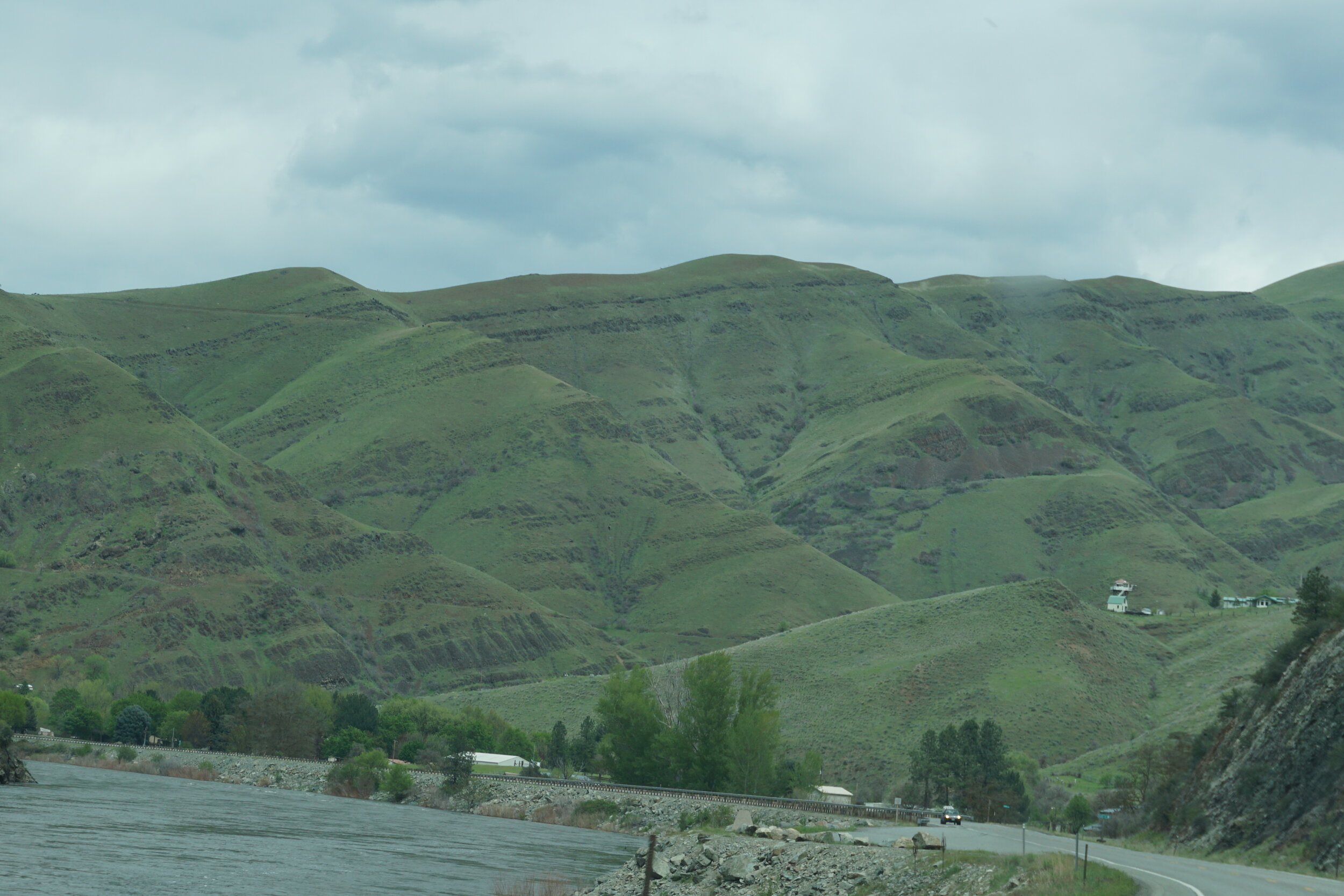


The ridgeline left of center is where the White Bird Grade is located. This photo is taken from the new US-95 grade. Even today some trucks still use the old road because of the steepness of the new road.
Lewiston has a grade too. The new one is four lanes wide and the fastest way down into the Snake and Clearwater River valleys. I’d recommend taking the old highway up to the top. It’s not as long as most old grades but it has some great views back to the valleys. It’s west of Lewiston along the Snake about 2 miles. You can get to it through Clarkston via US-12 and WA-128. Take it up or down. It’s not so steep to eat your brakes.
Leaving Lewiston you enter the Palouse. This is the common name for southeastern Washington’s wheat growing country. Big rolling hills extending for miles. All covered in green at this time of the year. Give it a couple months. It’s all winter wheat and it’s going to turn yellow as it ripens. Just about the start of the fall semester the growers start burning the fields after harvest. Our daughter could not open windows for days when the wind brings the field smoke over the campus. We like to drive north of Pullman, through Colfax and on to Steptoe where we catch WA-23 to Sprague and I-5. This is a pretty fast way from Pullman to Seattle. It’s a good road, wide lanes and shoulders that wouldn’t put you into a ditch with a small error.
Just outside of St. John there is an old octagonal barn on the south side of the highway. When we first drove this route in 2003 the roof was starting to collapse, like all old unmaintained barns tend to do. A few years ago I saw a story about the owner starting to restore it because of it’s uniqueness. I’ve seen round ones in Central Illinois but no octogonal ones. The roof has been repaired and looks good for lots more years.


Well, I’ve finally finished the April trip.
No trips this summer. We’ve been occupied with visiting my oldest brother who was diagnosed with idiopathic pulmonary fibrosis. He was given 5-7 years about 6 1/2 years ago and had been spending winters in Rodeo, NM near his daughter and son-in-laws vineyard, Copper Horse. He had to stop going this winter because his health would not let him make the drive anymore. When we got home in May his decline was obvious and we would go out weekly to help him with household chores to supplement the cleaning lady and his friends’ assistance with shopping and meals. He almost made the full 7 years but couldn’t get past the end of July. We had a memorial service for him on Vashon Island last weekend and we got to meet many of his island friends, whom he met on his 25+ years driving the bus on Vashon.
Great thanks to his good friends Craig and Lynette Belles for the help they gave him over the past years.
Our next trip will be to California for a wedding, Phoenix for a milestone birthday and back to San Francisco to get our Italian passports. This will set us up for another extended trip to Sicily and Italy, maybe Spain and southern France or Morocco next year. No 90 day visa restrictions anymore! Wooo Hooo!
Ciao for now.